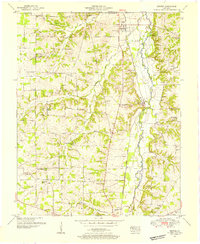
1951 Map of Dexter
USGS Topo · Published 1955About this map
The Nashville Chattanooga and St Louis railroad forms the structural backbone of this western Kentucky landscape, running parallel to the East Fork Clarks River. This corridor anchors the small settlements of Dexter and Almo, which serve as focal points for a rural area defined by a dense network of country churches and family burial grounds. Notable landmarks for local historians include the Coles Camp Ground Church and the Brooks Chapel School, alongside several family cemeteries such as the Trevathan Cem and McKeel Cem.
Find a feature on this map
64 named features on this map. Tap any name to fly to it.
Don’t see what you’re looking for? This feature index may not catch every label — zoom into the map to look around manually.
Map Details
Editions of this 1951 Dexter Map
2 editions found
Other maps of this area

1936 · Hazel
USGS Topo · 1:24,000

1936 · New Concord
USGS Topo · 1:24,000

1936 · Oak Level
USGS Topo · 1:24,000

1936 · Lynn Grove
USGS Topo · 1:24,000

1936 · Hardin
USGS Topo · 1:24,000

1936 · Hiatt
USGS Topo · 1:24,000

1936 · Benton
USGS Topo · 1:48,000

1936 · Golden Pond
USGS Topo · 1:48,000

1936 · Dexter
USGS Topo · 1:24,000

1936 · Hico
USGS Topo · 1:24,000