
1936 Map of Lynn Grove
USGS Topo · Published 1936About this map
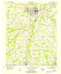
The Tennessee Basin Divide carves through this 1930s landscape, separating the headwaters of Mayfield Creek from the drainage of the East Fork Clarks River. This rural expanse in southern Kentucky is characterized by its network of early 20th-century social hubs, including small settlements like Lynn Grove and Browns Grove. The map is particularly useful for genealogists, as it documents numerous country churches and schools that anchored the local community before mid-century consolidation. Notable locations include Williams Chapel, Story Chapel, and Kelly Sch, alongside several family cemeteries such as Youngs Cem. The southern edge of the sheet follows the Kentucky Tennessee State Line, where the village of Crossland sits just north of the border. This survey represents a specific moment when State Highway No 94 and early power transmission lines began modernizing the transportation and energy infrastructure of this agricultural region.
Find a feature on this map
40 named features on this map. Tap any name to fly to it.
Don’t see what you’re looking for? This feature index may not catch every label — zoom into the map to look around manually.
Map Details
Editions of this 1936 Lynn Grove Map
This is the sole edition of this map. No revisions or reprints were ever made.
Other maps of this area

1936 · Conyersville
USGS Topo · 1:24,000

1936 · Farmington
USGS Topo · 1:24,000

1936 · Hazel
USGS Topo · 1:24,000

1936 · Crossland
USGS Topo · 1:24,000

1936 · Dexter
USGS Topo · 1:24,000

1936 · Kirksey
USGS Topo · 1:24,000

1950 · Puryear
USGS Topo · 1:24,000

1950 · Cottage Grove
USGS Topo · 1:24,000
1951 · Hazel
USGS Topo · 1:24,000

1951 · Kirksey
USGS Topo · 1:24,000