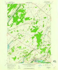
1958 Map of Dexter
USGS Topo · Published 1960About this map
Dexter stands at the mouth of the Black River as it empties into Black River Bay, serving as a focal point of this late 1950s survey. The village's industrial footprint is evident through the presence of a Pumping Sta and a network of roads leading inland to the General Brown High Sch. Northward, the village of Limerick marks a crossing over the Perch River, while the landscape is dotted with small family and local burial grounds like Freeman Cem and Luther Hill Cem.
Find a feature on this map
76 named features on this map. Tap any name to fly to it.
Don’t see what you’re looking for? This feature index may not catch every label — zoom into the map to look around manually.
Map Details
Editions of this 1958 Dexter Map
3 editions found
Other maps of this area

1893 · Sackets Harbor
USGS Topo · 1:62,500

1895 · Sacketts Harbor
USGS Topo · 1:62,500

1895 · Watertown
USGS Topo · 1:62,500

1898 · Watertown
USGS Topo · 1:62,500

1900 · Clayton
USGS Topo · 1:62,500

1903 · Clayton
USGS Topo · 1:62,500

1903 · Theresa
USGS Topo · 1:62,500

1908 · Watertown
USGS Topo · 1:62,500

1909 · Watertown
USGS Topo · 1:62,500

1942 · Henderson Bay
USGS Topo · 1:31,680