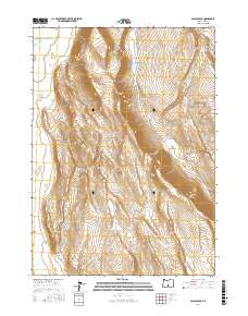
2017 Map of Diablo Peak
USGS Topo · Published 2017About this map
Diablo Peak rises as the central landmark in this high desert landscape of Lake County, anchored by the dramatic verticality of the Diablo Rim to its south. The terrain is defined by its water management and natural catchments, with West Whiskey Lake and Whiskey Hills marking the northeastern corner of the survey. The naming conventions suggest a ranching or prospecting history, as seen in the isolated Brief Reservoir, Slim Reservoir, and the curiously named Jackings Hole. Most of the map reflects a sparsely populated, surveyed interior partitioned into Townships and Ranges, including t30s r18e and t31s r19e, where Fourmile Point and Murphys Lake provide essential landmarks in an otherwise open, topographical expanse.
Find a feature on this map
13 named features on this map. Tap any name to fly to it.
Don’t see what you’re looking for? This feature index may not catch every label — zoom into the map to look around manually.
Map Details
Editions of this 2017 Diablo Peak Map
This is the sole edition of this map. No revisions or reprints were ever made.
Other maps of this area

1955 · Crescent
USGS Topo · 1:250,000

1955 · Klamath Falls
USGS Topo · 1:250,000

1957 · Crescent
USGS Topo · 1:250,000

1958 · Crescent
USGS Topo · 1:250,000

1958 · Klamath Falls
USGS Topo · 1:250,000

1970 · Crescent
USGS Topo · 1:250,000

1974 · Lake Abert
USGS Topo · 1:100,000

1985 · Sharp Top
USGS Topo · 1:24,000

1986 · St. Patrick Mtn.
USGS Topo · 1:24,000
1986 · Ana River
USGS Topo · 1:24,000