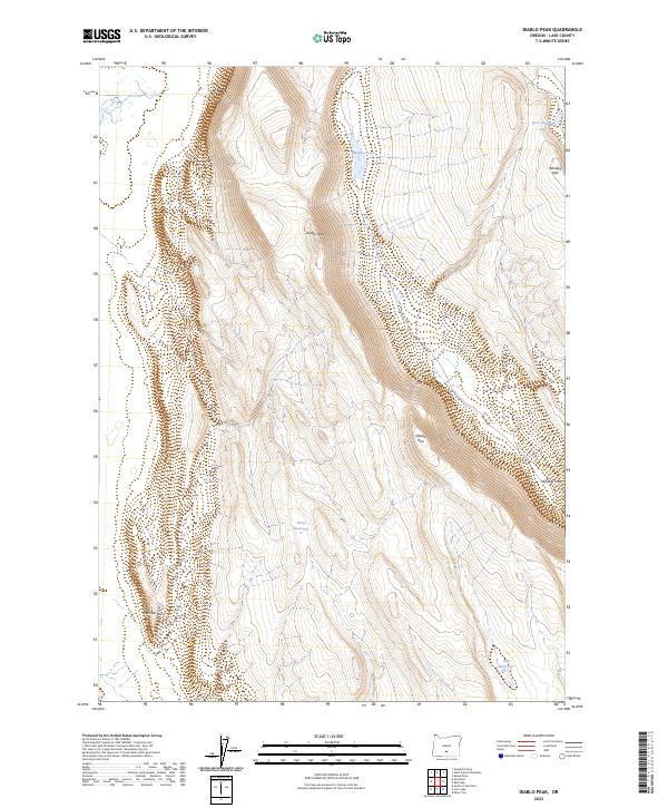
2023 Map of Diablo Peak
USGS Topo · Published 2023About this map
Diablo Peak rises as the central landmark of this high desert terrain in Lake County, defining a landscape shaped by dramatic escarpments and isolated water catchments. The topography is dominated by the massive Diablo Rim, which creates a sharp transition across the central and eastern sections of the quadrangle. This area is characterized by its reliance on seasonal water management, as evidenced by the presence of engineered features like Brief Reservoir and Slim Reservoir. To the northeast, the terrain softens into the Whiskey Hills, where West Whiskey Lake and Murphys Lake gather in natural depressions. The placement of these water sources and the sheer face of the rim reflect the logistical challenges of land use in this part of Oregon, where natural landmarks like Jackings Hole and Fourmile Point serve as essential orientation markers for navigators and land managers.
Find a feature on this map
13 named features on this map. Tap any name to fly to it.
Don’t see what you’re looking for? This feature index may not catch every label — zoom into the map to look around manually.
Map Details
Editions of this 2023 Diablo Peak Map
This is the sole edition of this map. No revisions or reprints were ever made.
Other maps of this area

1955 · Crescent
USGS Topo · 1:250,000

1955 · Klamath Falls
USGS Topo · 1:250,000

1957 · Crescent
USGS Topo · 1:250,000

1958 · Crescent
USGS Topo · 1:250,000

1958 · Klamath Falls
USGS Topo · 1:250,000

1970 · Crescent
USGS Topo · 1:250,000

1974 · Lake Abert
USGS Topo · 1:100,000

1985 · Sharp Top
USGS Topo · 1:24,000

1986 · St. Patrick Mtn.
USGS Topo · 1:24,000
1986 · Ana River
USGS Topo · 1:24,000