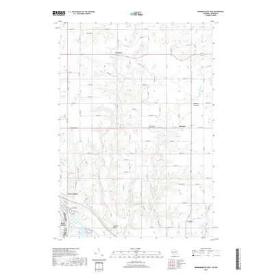
2018 Map of Diamond Bluff East
USGS Topo · Published 2018About this map
Diamond Bluff and the winding course of the Trimbelle River anchor this 2018 survey of the Pierce and Goodhue County borderlands. The landscape is defined by the sharp descent of the bluffs toward the Mississippi River valley, punctuated by named landforms like Negro Hill and Skidmore Bluff. This map records a rural township structure where small settlements such as Trimbelle, Moeville, and Ottman Corners serve as historic nodes for the surrounding agricultural community. For those researching local heritage, the map clearly identifies several community landmarks, including the Diamond Bluff Cem and Bethel Mission Covenant Cem. The intricate drainage system of Spring Cr and Little Trimbelle Cr carves deep into the high ground, creating the distinct coulees that characterize the region's topography.
Find a feature on this map
50 named features on this map. Tap any name to fly to it.
Don’t see what you’re looking for? This feature index may not catch every label — zoom into the map to look around manually.
Map Details
Editions of this 2018 Diamond Bluff East Map
This is the sole edition of this map. No revisions or reprints were ever made.
Other maps of this area

1940 · Maiden Rock
USGS Topo · 1:62,500

1944 · Red Wing
USGS Topo · 1:62,500

1946 · River Falls
USGS Topo · 1:62,500

1949 · River Falls
USGS Topo · 1:62,500

1949 · Baldwin
USGS Topo · 1:62,500

1950 · Maiden Rock
USGS Topo · 1:62,500

1952 · Red Wing
USGS Topo · 1:62,500

1953 · Saint Paul
USGS Topo · 1:250,000

1959 · Saint Paul
USGS Topo · 1:250,000
1974 · River Falls East
USGS Topo · 1:24,000