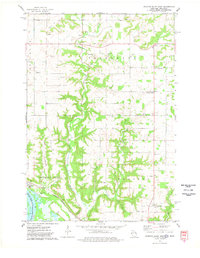
1974 Map of Diamond Bluff East
USGS Topo · Published 1978About this map
The Mississippi River valley and its dramatic bluffs define this section of Pierce County, where the Burlington Northern railroad tracks skirt the shoreline beneath Skidmore Bluff. The village of Diamond Bluff sits at the base of the highlands, while the interior plateau is dominated by the deeply incised valleys of the Trimbelle River and its tributaries, Spring Creek and Little Trimbelle Creek. This landscape is a patchwork of agricultural upland and wooded coulees, including Hope Coulee and Fisher Coulee.
Find a feature on this map
34 named features on this map. Tap any name to fly to it.
Don’t see what you’re looking for? This feature index may not catch every label — zoom into the map to look around manually.
Map Details
Editions of this 1974 Diamond Bluff East Map
This is the sole edition of this map. No revisions or reprints were ever made.
Other maps of this area

1940 · Maiden Rock
USGS Topo · 1:62,500

1944 · Red Wing
USGS Topo · 1:62,500

1946 · River Falls
USGS Topo · 1:62,500

1949 · River Falls
USGS Topo · 1:62,500

1949 · Baldwin
USGS Topo · 1:62,500

1950 · Maiden Rock
USGS Topo · 1:62,500

1952 · Red Wing
USGS Topo · 1:62,500

1953 · Saint Paul
USGS Topo · 1:250,000

1959 · Saint Paul
USGS Topo · 1:250,000
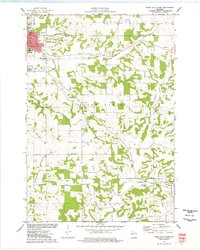
1974 · River Falls East
USGS Topo · 1:24,000