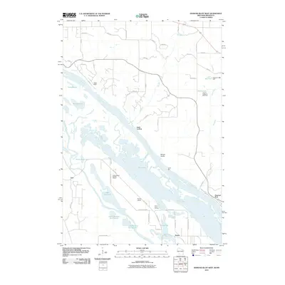
2010 Map of Diamond Bluff West
USGS Topo · Published 2010About this map
Prairie Island dominates this stretch of the Mississippi River valley, a complex landscape of backwater lakes and sloughs south of the river's bend. The area is defined by its watery geography, where the Vermillion River meanders toward Pool 3, feeding a series of basins including Spring Banks Lake, Upper Rattling Springs Lake, and Lower Rattling Springs Lake. Small settlements and landings like Smith Landing and Stroms are situated along these waterways, reflecting a long-standing relationship between the local communities and the river's edge.
Find a feature on this map
60 named features on this map. Tap any name to fly to it.
Don’t see what you’re looking for? This feature index may not catch every label — zoom into the map to look around manually.
Map Details
Editions of this 2010 Diamond Bluff West Map
This is the sole edition of this map. No revisions or reprints were ever made.
Other maps of this area

1944 · Red Wing
USGS Topo · 1:62,500

1946 · Hudson
USGS Topo · 1:62,500

1946 · River Falls
USGS Topo · 1:62,500

1949 · River Falls
USGS Topo · 1:62,500

1949 · Hudson
USGS Topo · 1:62,500

1951 · Prescott
USGS Topo · 1:24,000

1952 · Red Wing
USGS Topo · 1:62,500

1953 · Saint Paul
USGS Topo · 1:250,000

1957 · Hastings
USGS Topo · 1:62,500

1959 · Saint Paul
USGS Topo · 1:250,000