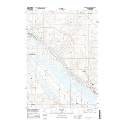
2015 Map of Diamond Bluff West
USGS Topo · Published 2015About this map
Mississippi River floodplains and the intricate backwaters of the Mississippi National River and Recreation Area dominate this borderland landscape. The river serves as a massive natural boundary between Pierce County, Wisconsin, and Dakota and Goodhue Counties in Minnesota. On the Minnesota side, Prairie Island sits between the main channel and the Vermillion River, housing the Prairie Island Cem and a dense network of wetlands like Upper Rattling Springs Lake and Sharp Muskrat Lake.
Find a feature on this map
107 named features on this map. Tap any name to fly to it.
Don’t see what you’re looking for? This feature index may not catch every label — zoom into the map to look around manually.
Map Details
Editions of this 2015 Diamond Bluff West Map
This is the sole edition of this map. No revisions or reprints were ever made.
Other maps of this area

1944 · Red Wing
USGS Topo · 1:62,500

1946 · Hudson
USGS Topo · 1:62,500

1946 · River Falls
USGS Topo · 1:62,500

1949 · River Falls
USGS Topo · 1:62,500

1949 · Hudson
USGS Topo · 1:62,500

1951 · Prescott
USGS Topo · 1:24,000

1952 · Red Wing
USGS Topo · 1:62,500

1953 · Saint Paul
USGS Topo · 1:250,000

1957 · Hastings
USGS Topo · 1:62,500

1959 · Saint Paul
USGS Topo · 1:250,000