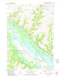
1974 Map of Diamond Bluff West
USGS Topo · Published 1978About this map
Mississippi River waters dominate this mid-1970s survey, marking the state line between Wisconsin and Minnesota. The complex hydrology of the valley is evident through a network of backwaters and sloughs, including Sturgeon Lake, Sharp Muskrat Lake, and Spring Banks Lake. On the Minnesota side, the Richard J Dorer Memorial Hardwood State Forest and the Prairie Island Indian Reservation Boundaries define much of the landscape, while the settlement of Etter sits near the Vermillion River.
Find a feature on this map
52 named features on this map. Tap any name to fly to it.
Don’t see what you’re looking for? This feature index may not catch every label — zoom into the map to look around manually.
Map Details
Editions of this 1974 Diamond Bluff West Map
This is the sole edition of this map. No revisions or reprints were ever made.
Other maps of this area

1944 · Red Wing
USGS Topo · 1:62,500

1946 · Hudson
USGS Topo · 1:62,500

1946 · River Falls
USGS Topo · 1:62,500

1949 · River Falls
USGS Topo · 1:62,500

1949 · Hudson
USGS Topo · 1:62,500

1951 · Prescott
USGS Topo · 1:24,000

1952 · Red Wing
USGS Topo · 1:62,500

1953 · Saint Paul
USGS Topo · 1:250,000

1957 · Hastings
USGS Topo · 1:62,500

1959 · Saint Paul
USGS Topo · 1:250,000