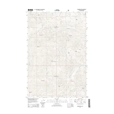
2014 Map of Diamond Point
USGS Topo · Published 2014About this map
Diamond Point stands as a prominent lookout over a deeply dissected landscape within the Lolo National Forest during the early 2010s. This portion of Missoula County is defined by its sharp drainage network, where seasonal and perennial waters such as Rock Cr and Gilman Cr have carved a series of named gulches. Landmarks like French Gulch and Emma Gulch suggest a history of prospecting or early naming conventions tied to the region's physical geography. Transport through these steep draws is limited to forest routes like Albert Creek Rd and Deep Creek Rd, which provide access to high elevations including Albert Point and Wild Horse Point. The presence of the Grave Creek Range in the southwest corner further illustrates the high-relief environment that characterizes this section of the Northern Rockies.
Find a feature on this map
25 named features on this map. Tap any name to fly to it.
Don’t see what you’re looking for? This feature index may not catch every label — zoom into the map to look around manually.
Map Details
Editions of this 2014 Diamond Point Map
This is the sole edition of this map. No revisions or reprints were ever made.
Other maps of this area

1912 · Missoula
USGS Topo · 1:125,000

1956 · Wallace
USGS Topo · 1:250,000

1956 · Hamilton
USGS Topo · 1:250,000

1959 · Hamilton
USGS Topo · 1:250,000

1959 · Alberton
USGS Topo · 1:62,500

1959 · Arlee
USGS Topo · 1:62,500

1960 · Wallace
USGS Topo · 1:250,000

1960 · Hamilton
USGS Topo · 1:250,000

1963 · Primrose
USGS Topo · 1:24,000

1964 · Hamilton
USGS Topo · 1:250,000