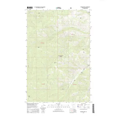
2017 Map of Diamond Point
USGS Topo · Published 2017About this map
Lolo National Forest dominates this landscape in Missoula County, where the high elevations of the Grave Creek Range meet a dense network of drainages. The topography is defined by sharp ridges and deep incisions, notably at Diamond Point and Albert Point, which overlook a series of named gulches including French Gulch and Emma Gulch. These features trace the natural drainage patterns into Albert Cr and Gilman Cr, illustrating the complex watershed management within federal forest lands.
Find a feature on this map
27 named features on this map. Tap any name to fly to it.
Don’t see what you’re looking for? This feature index may not catch every label — zoom into the map to look around manually.
Map Details
Editions of this 2017 Diamond Point Map
This is the sole edition of this map. No revisions or reprints were ever made.
Other maps of this area

1912 · Missoula
USGS Topo · 1:125,000

1956 · Wallace
USGS Topo · 1:250,000

1956 · Hamilton
USGS Topo · 1:250,000

1959 · Hamilton
USGS Topo · 1:250,000

1959 · Alberton
USGS Topo · 1:62,500

1959 · Arlee
USGS Topo · 1:62,500

1960 · Wallace
USGS Topo · 1:250,000

1960 · Hamilton
USGS Topo · 1:250,000

1963 · Primrose
USGS Topo · 1:24,000

1964 · Hamilton
USGS Topo · 1:250,000