
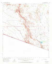
1963 Map of Diaz Peak
USGS Topo · Published 1965About this map
The Papago Indian Reservation and the Organ Pipe Cactus National Monument converge in this Pima County landscape, recorded during the early 1960s. The geography is defined by the prominent Ajo Range and the Sierra de Santa Rosa, which divide the terrain into distinct desert basins like the Pia Oik Valley and La Quituni Valley. Small settlements and ranching outposts such as Ali Chuk, Siovi Shuatak, and Gray Ranch are connected by a network of unimproved roads and trails, illustrating the remote habitation patterns of the Sonoran Desert. Vital water sources are scattered across the arid expanse, including Menagers Lake, Blankenship Well, and Adams Well. To the north, the terrain rises toward the Diablo Mts and Sweetwater Pass, while the southern boundary follows the international border between the United States and Mexico.
Find a feature on this map
35 named features on this map. Tap any name to fly to it.
Don’t see what you’re looking for? This feature index may not catch every label — zoom into the map to look around manually.
Map Details
Editions of this 1963 Diaz Peak Map
2 editions found
Other maps of this area

1953 · Ajo
USGS Topo · 1:250,000

1954 · Sonoyta
USGS Topo · 1:250,000

1957 · Ajo
USGS Topo · 1:250,000

1958 · Ajo
USGS Topo · 1:250,000

1962 · Ajo
USGS Topo · 1:250,000

1963 · Ajo
USGS Topo · 1:250,000

1963 · Kom Vo
USGS Topo · 1:62,500

1963 · Mt. Ajo
USGS Topo · 1:62,500

1963 · Lukeville
USGS Topo · 1:62,500

1963 · Pisinimo
USGS Topo · 1:62,500
Featured Places
- Gu Vo District, AZ
- Ali Ak Chin, Gu Vo District
- Ali Chuk, Gu Vo District
- Sweetwater, Gu Vo District
- Siovi Shuatak, Gu Vo District