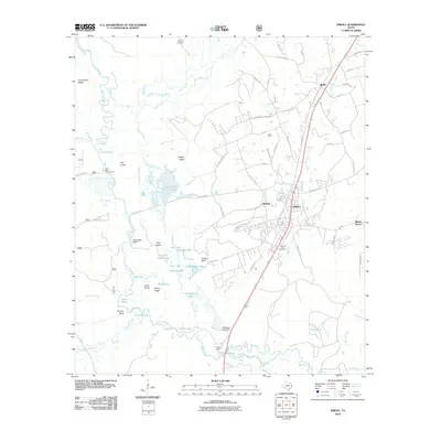
2010 Map of Diboll
USGS Topo · Published 2010About this map
The Neches River defines the western edge of this East Texas landscape, weaving through a complex network of backwaters like Long Slough and Allred Lake. The regional timber and manufacturing economy is anchored by Diboll, where the Fiberboard Lake Dam and Fiberboard Lake suggest industrial water use adjacent to the town's residential streets. To the north, the settlement of Burke sits along the primary transport corridor, while smaller communities like Pine Valley and Rutland dot the pine-heavy terrain between the river and White Oak Creek.
Find a feature on this map
84 named features on this map. Tap any name to fly to it.
Don’t see what you’re looking for? This feature index may not catch every label — zoom into the map to look around manually.
Map Details
Editions of this 2010 Diboll Map
This is the sole edition of this map. No revisions or reprints were ever made.
Other maps of this area

1927 · Lufkin 4-c
USGS Topo · 1:24,000

1932 · Manning
USGS Topo · 1:62,500

1949 · Lufkin
USGS Topo · 1:62,500

1949 · Lufkin
USGS Topo · 1:24,000

1949 · Keltys
USGS Topo · 1:24,000

1950 · Keltys
USGS Topo · 1:24,000

1950 · Lufkin
USGS Topo · 1:24,000

1951 · Wells SW
USGS Topo · 1:24,000

1953 · Palestine
USGS Topo · 1:250,000

1957 · Palestine
USGS Topo · 1:250,000