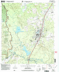
2004 Map of Diboll
USGS Topo · Published 2006About this map
The Neches River meanders along the western edge of this East Texas survey, carving a complex landscape of sloughs and oxbow lakes like East Pine Island Lake and Brushy Lake. The industrial character of Diboll is evident in its large facility adjacent to the Angelina & Neches River Rr, reflecting the region's deep ties to timber and manufacturing. This economy is further emphasized by the presence of Fiberboard Lake and the vast Davy Crockett National Forest which occupies the western bank. Rural life is anchored by landmarks such as Ryan Chapel and the nearby Pine Valley settlement. For genealogists, the map preserves the locations of several burial grounds, including McCarty Cem and Pleasant View Cem, while old crossings like Clarks Ferry hint at earlier transportation networks before the modernization of the local road system.
Find a feature on this map
65 named features on this map. Tap any name to fly to it.
Don’t see what you’re looking for? This feature index may not catch every label — zoom into the map to look around manually.
Map Details
Editions of this 2004 Diboll Map
This is the sole edition of this map. No revisions or reprints were ever made.
Other maps of this area

1927 · Lufkin 4-c
USGS Topo · 1:24,000

1932 · Manning
USGS Topo · 1:62,500

1949 · Lufkin
USGS Topo · 1:62,500

1949 · Lufkin
USGS Topo · 1:24,000

1949 · Keltys
USGS Topo · 1:24,000

1950 · Keltys
USGS Topo · 1:24,000

1950 · Lufkin
USGS Topo · 1:24,000

1951 · Wells SW
USGS Topo · 1:24,000

1953 · Palestine
USGS Topo · 1:250,000

1957 · Palestine
USGS Topo · 1:250,000