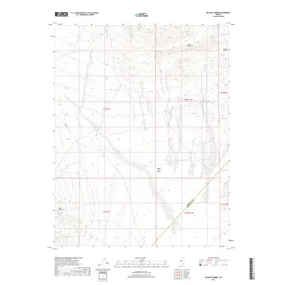
2018 Map of Dicalite Summit
USGS Topo · Published 2018About this map
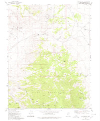
Dicalite Summit rises above the high desert floor where the Cedar Mountains and Pilot Mountains meet in this 2018 survey. The landscape is defined by the broad expanse of the Monte Cristo Valley, a characteristic Great Basin landform that stretches across the central portion of the sheet. Evidence of human movement and utility is sparse in this arid environment, marked primarily by the utilitarian Dump Rd and the vital presence of Tree Spring on the western slopes. The map also delineates the high-altitude boundary between Mineral and Esmeralda counties, illustrating how political borders were drawn across this remote terrain. This record provides a clear view of the topography and drainage patterns at the intersection of several township and range grids, serving as a modern reference for the natural geography of the region.
Find a feature on this map
13 named features on this map. Tap any name to fly to it.
Don’t see what you’re looking for? This feature index may not catch every label — zoom into the map to look around manually.
Map Details
Editions of this 2018 Dicalite Summit Map
This is the sole edition of this map. No revisions or reprints were ever made.
Other maps of this area

1907 · Tonopah
USGS Topo · 1:250,000

1908 · Tonopah
USGS Topo · 1:250,000

1956 · Tonopah
USGS Topo · 1:250,000

1959 · Tonopah
USGS Topo · 1:250,000

1962 · Tonopah
USGS Topo · 1:250,000
1979 · Stewart Spring
USGS Topo · 1:24,000
1979 · Simon
USGS Topo · 1:24,000
1980 · Kibby Flat
USGS Topo · 1:24,000

1980 · Cole Spring
USGS Topo · 1:24,000
1980 · Bettles Well
USGS Topo · 1:24,000