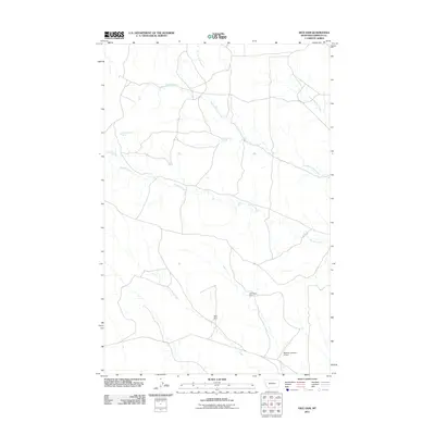
2011 Map of Dice Dam
USGS Topo · Published 2011About this map
Phillips Creek and its many branches form the primary drainage system for this corner of Garfield County, where the landscape is defined by the vital management of water resources in a dry environment. The map details a network of earthen structures and natural sources, including Dice Dam and Old Stove Dam, which are essential for supporting local ranching operations. Numerous springs, such as Upper Hanson Spring, Lower Hanson Spring, and Seventynine Spring, provide localized water points across the terrain. The hydrological pattern is further defined by the convergences of the Middle Phillips Creek and North Phillips Creek, along with the E Fk Long Branch Cr in the north. This survey illustrates the spatial distribution of water improvements like the Beecher Number 5 Dam, reflecting the necessary infrastructure for land use in this part of Montana.
Find a feature on this map
10 named features on this map. Tap any name to fly to it.
Don’t see what you’re looking for? This feature index may not catch every label — zoom into the map to look around manually.
Map Details
Editions of this 2011 Dice Dam Map
This is the sole edition of this map. No revisions or reprints were ever made.
Other maps of this area

1954 · Jordan
USGS Topo · 1:250,000

1954 · Forsyth
USGS Topo · 1:250,000

1956 · Jordan
USGS Topo · 1:250,000

1957 · Forsyth
USGS Topo · 1:250,000

1958 · Jordan
USGS Topo · 1:250,000

1958 · Forsyth
USGS Topo · 1:250,000

1964 · Jordan
USGS Topo · 1:250,000

1965 · Black Hills
USGS Topo · 1:24,000

1965 · Kirby Ranch
USGS Topo · 1:24,000

1965 · Darby Buttes
USGS Topo · 1:24,000