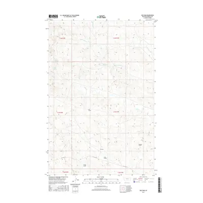
2017 Map of Dice Dam
USGS Topo · Published 2017About this map
Dice Dam and its surrounding watershed characterize this 2017 study of Garfield County, where the high plains are carved by a complex network of ephemeral drainages and intermittent springs. The landscape is defined by its series of coulees, including Coil Coulee, Knudson Coulee, and Tinsley Coulee, which serve as vital topographic markers in this expansive ranching country. These features emphasize the critical role of water management in eastern Montana, particularly with the placement of water sources like Upper Hanson Spring and Seventynine Spring.
Find a feature on this map
19 named features on this map. Tap any name to fly to it.
Don’t see what you’re looking for? This feature index may not catch every label — zoom into the map to look around manually.
Map Details
Editions of this 2017 Dice Dam Map
This is the sole edition of this map. No revisions or reprints were ever made.
Other maps of this area

1954 · Jordan
USGS Topo · 1:250,000

1954 · Forsyth
USGS Topo · 1:250,000

1956 · Jordan
USGS Topo · 1:250,000

1957 · Forsyth
USGS Topo · 1:250,000

1958 · Jordan
USGS Topo · 1:250,000

1958 · Forsyth
USGS Topo · 1:250,000

1964 · Jordan
USGS Topo · 1:250,000

1965 · Black Hills
USGS Topo · 1:24,000

1965 · Kirby Ranch
USGS Topo · 1:24,000

1965 · Darby Buttes
USGS Topo · 1:24,000