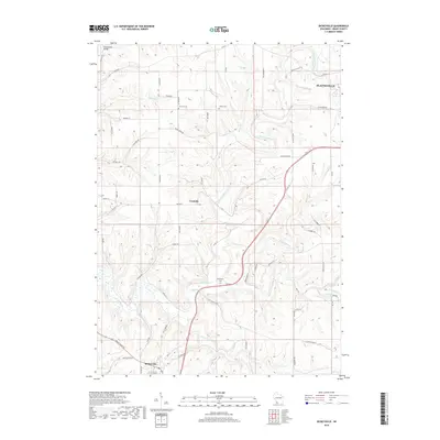
2018 Map of Dickeyville
USGS Topo · Published 2018About this map
The Little Platte River snakes through a deeply dissected landscape in south-central Grant County, defining the agricultural and residential patterns of the region. The city of Platteville occupies the northeastern corner of the map, while the village of Dickeyville anchors the southwest, connected by the arterial path of the Great River Rd. Between these centers, the terrain is carved by numerous tributaries including Blockhouse Creek, Whig Branch, and Blakely Branch. For local historians and genealogists, the map reveals several smaller rural nodes and family burial sites, such as the cross-road settlement of Cornelia and the dispersed locations of Harrison Cemetery, Kaup Cemetery, and Piddington Cemetery. This survey illustrates how the ridge-and-valley topography has dictated the placement of local thoroughfares like Maple Ridge Road and the crossing at the Platte Road Bridge.
Find a feature on this map
61 named features on this map. Tap any name to fly to it.
Don’t see what you’re looking for? This feature index may not catch every label — zoom into the map to look around manually.
Map Details
Editions of this 2018 Dickeyville Map
This is the sole edition of this map. No revisions or reprints were ever made.
Other maps of this area

1900 · Lancaster
USGS Topo · 1:125,000

1902 · Mineral Point
USGS Topo · 1:125,000

1904 · Lancaster
USGS Topo · 1:125,000

1908 · Lancaster
USGS Topo · 1:125,000

1952 · Platteville
USGS Topo · 1:24,000

1952 · Rewey
USGS Topo · 1:24,000

1952 · Cuba City
USGS Topo · 1:24,000

1956 · Dubuque North
USGS Topo · 1:24,000

1957 · Potosi
USGS Topo · 1:24,000

1959 · Dubuque
USGS Topo · 1:250,000