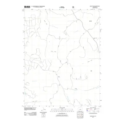
2011 Map of Dicks Peak
USGS Topo · Published 2011About this map
Threemile Mountain and Dicks Peak anchor this high-elevation landscape in Park County, where the terrain is defined by a dense network of gulches and creeks. Seasonal activity is marked by Fehlings Cow Camp and Shimmins Camp, reflecting the region's ranching heritage. The drainage system is particularly complex, with Buffalo Gulch and Sheep Gulch feeding into larger arteries like Threemile Creek and Currant Creek, the latter of which flows south from Currant Creek Pass.
Find a feature on this map
41 named features on this map. Tap any name to fly to it.
Don’t see what you’re looking for? This feature index may not catch every label — zoom into the map to look around manually.
Map Details
Editions of this 2011 Dicks Peak Map
This is the sole edition of this map. No revisions or reprints were ever made.
Other maps of this area

1954 · Pueblo
USGS Topo · 1:250,000

1956 · Antero Reservoir NE
USGS Topo · 1:24,000

1956 · Guffey NW
USGS Topo · 1:24,000

1956 · Spinney Mountain
USGS Topo · 1:24,000

1956 · Cameron Mountain
USGS Topo · 1:62,500

1957 · Pueblo
USGS Topo · 1:250,000

1958 · Pueblo
USGS Topo · 1:250,000

1959 · Antero Reservoir
USGS Topo · 1:62,500

1959 · Black Mountain
USGS Topo · 1:62,500

1959 · Guffey
USGS Topo · 1:62,500