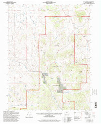
1994 Map of Dicks Peak
USGS Topo · Published 1998About this map
Pike National Forest dominates this high-altitude landscape in central Colorado, where numerous drainages carve through the terrain. The sheet is anchored by Dicks Peak and Threemile Mountain, providing a clear view of the complex water systems that define the region. High passes and deep gulches, such as Currant Creek Pass and the winding Buffalo Gulch, illustrate the natural corridors used for navigation through the mountains.
Find a feature on this map
16 named features on this map. Tap any name to fly to it.
Don’t see what you’re looking for? This feature index may not catch every label — zoom into the map to look around manually.
Map Details
Editions of this 1994 Dicks Peak Map
2 editions found
Other maps of this area

1954 · Pueblo
USGS Topo · 1:250,000

1956 · Antero Reservoir NE
USGS Topo · 1:24,000

1956 · Guffey NW
USGS Topo · 1:24,000

1956 · Spinney Mountain
USGS Topo · 1:24,000

1956 · Cameron Mountain
USGS Topo · 1:62,500

1957 · Pueblo
USGS Topo · 1:250,000

1958 · Pueblo
USGS Topo · 1:250,000

1959 · Antero Reservoir
USGS Topo · 1:62,500

1959 · Black Mountain
USGS Topo · 1:62,500

1959 · Guffey
USGS Topo · 1:62,500