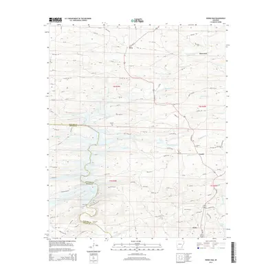
2014 Map of Dierks Dam
USGS Topo · Published 2014About this map
Dierks Lake and the engineered control of the Saline River define this corner of Southwest Arkansas, where the Howard Co Sevier Co boundary follows the water's path. This modern survey illustrates the persistent rural character of the region, anchored by the settlement of Dierks and smaller nodes like Burg and Euclid. The map preserves several community landmarks essential for genealogists, including Davis Cem, Old Liberty Cem, and Hickory Grove Cem. Local commerce and transit are marked by historic crossing points such as Davis Ford and Flowers Mill Crossing. The terrain is shaped by numerous tributaries including Caney Cr and Brushy Cr, while prominent ridges like Blue Ridge and Mountain Mist frame the river valley's north-to-south descent toward the reservoir.
Find a feature on this map
98 named features on this map. Tap any name to fly to it.
Don’t see what you’re looking for? This feature index may not catch every label — zoom into the map to look around manually.
Map Details
Editions of this 2014 Dierks Dam Map
This is the sole edition of this map. No revisions or reprints were ever made.
Other maps of this area

1906 · Caddo Gap
USGS Topo · 1:125,000

1913 · De Queen
USGS Topo · 1:125,000

1936 · Athens
USGS Topo · 1:48,000

1942 · Athens
USGS Topo · 1:62,500

1950 · Mcalester
USGS Topo · 1:250,000

1955 · Little Rock
USGS Topo · 1:250,000

1956 · Little Rock
USGS Topo · 1:250,000

1959 · Umpire
USGS Topo · 1:62,500

1960 · Little Rock
USGS Topo · 1:250,000

1962 · McAlester
USGS Topo · 1:250,000