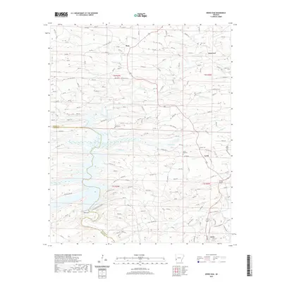
2020 Map of Dierks Dam
USGS Topo · Published 2020About this map
Dierks Dam controls the waters of the Saline River in this area of Southwest Arkansas, where the landscape is defined by the transition from river bottomlands to the rising ridges of the Ouachita foothills. The town of Dierks sits at the southern edge of the sheet, serving as a hub for the local timber and agricultural economy. The survey reveals a network of rural settlements and family-named locations such as Burg, Davis Ford, and Euclid. For those tracing local history or genealogy, the map includes several burial sites, including Davis Cem, Oak Hill Cem, and Hickory Grove Cem. Numerous creeks, such as Caney Cr and Brushy Cr, feed into the Saline, illustrating the complex drainage of the Howard and Sevier county line. The presence of Blue Ridge Rd and various forest roads underscores the importance of land management and recreation in this riverine environment.
Find a feature on this map
56 named features on this map. Tap any name to fly to it.
Don’t see what you’re looking for? This feature index may not catch every label — zoom into the map to look around manually.
Map Details
Editions of this 2020 Dierks Dam Map
This is the sole edition of this map. No revisions or reprints were ever made.
Other maps of this area

1906 · Caddo Gap
USGS Topo · 1:125,000

1913 · De Queen
USGS Topo · 1:125,000

1936 · Athens
USGS Topo · 1:48,000

1942 · Athens
USGS Topo · 1:62,500

1950 · Mcalester
USGS Topo · 1:250,000

1955 · Little Rock
USGS Topo · 1:250,000

1956 · Little Rock
USGS Topo · 1:250,000

1959 · Umpire
USGS Topo · 1:62,500

1960 · Little Rock
USGS Topo · 1:250,000

1962 · McAlester
USGS Topo · 1:250,000