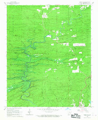
1966 Map of Dierks Dam
USGS Topo · Published 1967About this map
Dierks Dam (Under Constr) marks a period of profound transition for this portion of Howard Co and Sevier Co. While the Saline River still follows its original winding course, blue hatching indicates the extensive area soon to be submerged by the Dierks Reservoir. This development signaled the end of the traditional landscape of small settlements and river crossings like Mail Ford and Davis Ford. The map preserves the locations of rural communities such as Burg and Euclid, along with social centers including Liberty Hill Ch and the Church of Christ. For genealogists, the survey identifies several burial sites, such as Hickory Grove Cem and Old Liberty Cem, which provide essential points of reference before the valley was permanently altered by controlled inundation.
Find a feature on this map
35 named features on this map. Tap any name to fly to it.
Don’t see what you’re looking for? This feature index may not catch every label — zoom into the map to look around manually.
Map Details
Editions of this 1966 Dierks Dam Map
This is the sole edition of this map. No revisions or reprints were ever made.
Other maps of this area

1906 · Caddo Gap
USGS Topo · 1:125,000

1913 · De Queen
USGS Topo · 1:125,000

1936 · Athens
USGS Topo · 1:48,000

1942 · Athens
USGS Topo · 1:62,500

1950 · Mcalester
USGS Topo · 1:250,000

1955 · Little Rock
USGS Topo · 1:250,000

1956 · Little Rock
USGS Topo · 1:250,000

1959 · Umpire
USGS Topo · 1:62,500

1960 · Little Rock
USGS Topo · 1:250,000

1962 · McAlester
USGS Topo · 1:250,000