2024 Map of Dierks
USGS Topo · Published 2024About this map
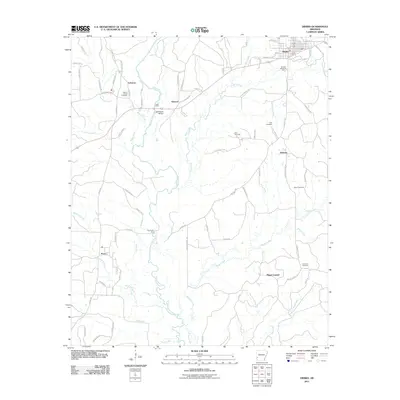
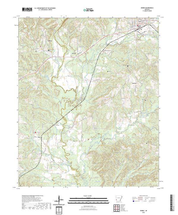
The Saline River winds through the heart of this Howard and Sevier County borderland, defining a landscape marked by small rural communities and extensive woodland. The town of Dierks serves as a primary hub in the northeast, characterized by its residential grid and proximity to Holly Creek. Moving south and west, the terrain transitions into a patchwork of timber tracts and scattered settlements such as Lebanon, Atwood, and Provo. The area is notably dense with small family and community burial grounds, including Greens Chapel Cem and Potts Cem, which offer significant touchstones for genealogical research in this part of Arkansas.
Find a feature on this map
93 named features on this map. Tap any name to fly to it.
Don’t see what you’re looking for? This feature index may not catch every label — zoom into the map to look around manually.
Map Details
Editions of this 2024 Dierks Map
This is the sole edition of this map. No revisions or reprints were ever made.
Historical Maps of Dierks Through Time
6 maps found