
1951 Map of Lockesburg
USGS Topo · Published 1952About this map
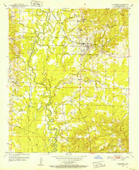
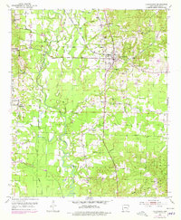
Lockesburg serves as the central hub of this Sevier County landscape, where the flatlands of the Cossatot River valley meet the rising topography of Rock Hill. The 1950s settlement pattern is defined by several rural clusters and their respective houses of worship, including Old Union Ch, Mt Carmel Ch, and the community of Bellville. The intricate hydrology of the area is striking, with the main river channel flanked by White Oak Slough, Sycamore Slough, and Russey Lake, suggesting a floodplain that dictated the placement of roads and farmsteads. To the west, Little Cossatot River and Clear Creek wind through the terrain, while smaller hamlets like Dilworth and Stringtown appear along the early road network. Genealogists will find significant value in the detailed plotting of rural landmarks such as Mt Ida Ch and the Sand Field Cem, preserved here just as they stood at mid-century.
Find a feature on this map
32 named features on this map. Tap any name to fly to it.
Don’t see what you’re looking for? This feature index may not catch every label — zoom into the map to look around manually.
Map Details
Editions of this 1951 Lockesburg Map
3 editions found
Other maps of this area

1913 · De Queen
USGS Topo · 1:125,000

1950 · Mcalester
USGS Topo · 1:250,000

1950 · Ben Lomond
USGS Topo · 1:24,000

1950 · Falls Chapel
USGS Topo · 1:24,000

1950 · Winthrop
USGS Topo · 1:24,000

1951 · Winthrop
USGS Topo · 1:24,000

1951 · Ben Lomond
USGS Topo · 1:24,000

1951 · Falls Chapel
USGS Topo · 1:24,000

1951 · Horatio
USGS Topo · 1:24,000

1951 · Silver Ridge
USGS Topo · 1:24,000