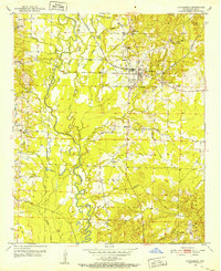
1951 Map of Lockesburg
USGS Topo · Published 1952About this map
The town of Lockesburg serves as the central hub of this Sevier County survey, situated just north of the winding Cossatot River. In the early 1950s, the landscape was defined by its relationship to the river’s many branches and sloughs, such as Russey Slough and Sandy Slough, which carved through the timberlands. The De Queen and Eastern railroad cuts through the northern section, connecting the rural communities of Bellville and Stringtown to the wider region. Several country churches, including Mt Ida Ch and Old Bellville Ch, reflect the established social fabric of the area. The prevalence of sloughs and lakes like Russey Lake suggests a seasonal floodplain environment where transport was dictated by the high ground of Rock Hill and various unnamed ridges.
Find a feature on this map
36 named features on this map. Tap any name to fly to it.
Don’t see what you’re looking for? This feature index may not catch every label — zoom into the map to look around manually.
Map Details
Editions of this 1951 Lockesburg Map
3 editions found
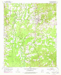
Other maps of this area

1913 · De Queen
USGS Topo · 1:125,000

1950 · Mcalester
USGS Topo · 1:250,000

1950 · Ben Lomond
USGS Topo · 1:24,000

1950 · Falls Chapel
USGS Topo · 1:24,000

1950 · Winthrop
USGS Topo · 1:24,000

1951 · Winthrop
USGS Topo · 1:24,000

1951 · Ben Lomond
USGS Topo · 1:24,000

1951 · Falls Chapel
USGS Topo · 1:24,000

1951 · Horatio
USGS Topo · 1:24,000

1951 · Lockesburg
USGS Topo · 1:24,000