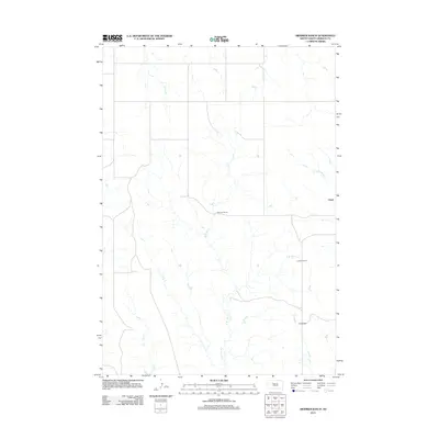
2012 Map of Diermier Ranch
USGS Topo · Published 2012About this map
Diermier Ranch serves as a focal point in this portion of Ziebach County, illustrating the enduring ranching character of the South Dakota plains in the early 21st century. The landscape is defined by its drainage systems rather than dense settlement, with W Br Ash Cr and E Br Ash Cr carving through the terrain. These waterways, along with Girl Cr and Cottonwood Cr, dictate the placement of roads and homesteads across the section lines. The presence of named locations such as Chase, Johnson Ranch, and Fields Ranch underscores a pattern of land use where family-named holdings remain the primary markers of human geography. This 2012 survey provides a precise record of these rural footprints and the sparse infrastructure connecting them.
Find a feature on this map
8 named features on this map. Tap any name to fly to it.
Don’t see what you’re looking for? This feature index may not catch every label — zoom into the map to look around manually.
Map Details
Editions of this 2012 Diermier Ranch Map
This is the sole edition of this map. No revisions or reprints were ever made.
Other maps of this area

1953 · McIntosh
USGS Topo · 1:250,000

1954 · Pierre
USGS Topo · 1:250,000

1958 · Pierre
USGS Topo · 1:250,000

1958 · McIntosh
USGS Topo · 1:250,000

1979 · Dupree
USGS Topo · 1:25,000

1982 · Bull Creek 2 NE
USGS Topo · 1:24,000

1982 · Red Scaffold
USGS Topo · 1:24,000

1982 · Miller Dam
USGS Topo · 1:24,000

1982 · Longbrake Ranch
USGS Topo · 1:24,000
1982 · Diermier Ranch
USGS Topo · 1:24,000