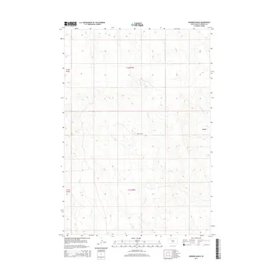
2015 Map of Diermier Ranch
USGS Topo · Published 2015About this map
Diermier Ranch stands as a central landmark in this Ziebach County landscape, where the prairie is defined by a dendritic network of seasonal drainages. The area is marked by the winding courses of the W Br Ash Cr and E Br Ash Cr, which converge as they flow through the central townships. The small settlement of Chase is positioned near the eastern edge of the quadrangle, adjacent to the upper reaches of Cottonwood Cr. These geographic features, including the aptly named Girl Cr in the southwest, illustrate the traditional ranching orientation of this South Dakota region. The topographic detail provided by the U.S. Geological Survey captures the subtle elevation changes that directed early settlement and grazing patterns long before modern development altered the Great Plains.
Find a feature on this map
10 named features on this map. Tap any name to fly to it.
Don’t see what you’re looking for? This feature index may not catch every label — zoom into the map to look around manually.
Map Details
Editions of this 2015 Diermier Ranch Map
This is the sole edition of this map. No revisions or reprints were ever made.
Other maps of this area

1953 · McIntosh
USGS Topo · 1:250,000

1954 · Pierre
USGS Topo · 1:250,000

1958 · Pierre
USGS Topo · 1:250,000

1958 · McIntosh
USGS Topo · 1:250,000

1979 · Dupree
USGS Topo · 1:25,000

1982 · Bull Creek 2 NE
USGS Topo · 1:24,000

1982 · Red Scaffold
USGS Topo · 1:24,000

1982 · Miller Dam
USGS Topo · 1:24,000

1982 · Longbrake Ranch
USGS Topo · 1:24,000
1982 · Diermier Ranch
USGS Topo · 1:24,000