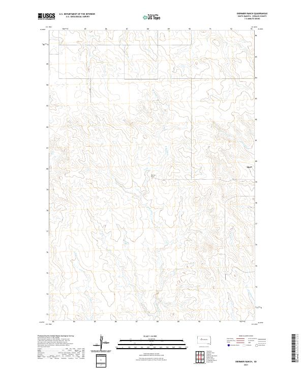
2021 Map of Diermier Ranch
USGS Topo · Published 2021About this map
Diermier Ranch stands as a central landmark in this sparse region of Ziebach County, characterized by the branching drainage systems that carve through the high plains. The landscape is defined by the headwaters and intermittent flows of W Br Ash Cr and E Br Ash Cr, which dictate the placement of ranching infrastructure and local transit. To the northeast, the settlement of Chase sits near the winding path of Cottonwood Cr, illustrating the historical reliance on water sources in this portion of South Dakota.
Find a feature on this map
11 named features on this map. Tap any name to fly to it.
Don’t see what you’re looking for? This feature index may not catch every label — zoom into the map to look around manually.
Map Details
Editions of this 2021 Diermier Ranch Map
This is the sole edition of this map. No revisions or reprints were ever made.
Other maps of this area

1953 · McIntosh
USGS Topo · 1:250,000

1954 · Pierre
USGS Topo · 1:250,000

1958 · Pierre
USGS Topo · 1:250,000

1958 · McIntosh
USGS Topo · 1:250,000

1979 · Dupree
USGS Topo · 1:25,000

1982 · Bull Creek 2 NE
USGS Topo · 1:24,000

1982 · Red Scaffold
USGS Topo · 1:24,000

1982 · Miller Dam
USGS Topo · 1:24,000

1982 · Longbrake Ranch
USGS Topo · 1:24,000
1982 · Diermier Ranch
USGS Topo · 1:24,000