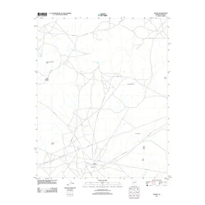
2011 Map of Dilkon
USGS Topo · Published 2011About this map
Dilkon serves as the primary hub for this high-desert region of the Navajo Nation, situated at the base of Dilkon Hill. The landscape is defined by its widely dispersed water sources and prominent geological markers that have likely served as navigational waypoints for generations. To the northwest, Cedar Springs and Lone Cottonwood Spring mark vital points on the map, while Tees Toh Spring provides a northern anchor.
Find a feature on this map
24 named features on this map. Tap any name to fly to it.
Don’t see what you’re looking for? This feature index may not catch every label — zoom into the map to look around manually.
Map Details
Editions of this 2011 Dilkon Map
This is the sole edition of this map. No revisions or reprints were ever made.
Other maps of this area

1883 · Tusayan
USGS Topo · 1:250,000

1886 · Tusayan
USGS Topo · 1:250,000

1947 · Flagstaff
USGS Topo · 1:250,000

1954 · Flagstaff
USGS Topo · 1:250,000

1958 · Flagstaff
USGS Topo · 1:250,000

1960 · Flagstaff
USGS Topo · 1:250,000

1962 · Flagstaff
USGS Topo · 1:250,000

1966 · White Cone
USGS Topo · 1:62,500

1966 · Egloffstein Butte
USGS Topo · 1:62,500
1967 · Dilkon
USGS Topo · 1:24,000
Featured Places
- Fort Defiance Agency
- Dilkon, Fort Defiance Agency
- Cedar Springs, Fort Defiance Agency
- Navajo County, AZ
- United States