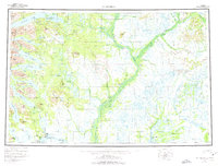
1954 Map of Dillingham
USGS Topo · Published 1975About this map
Dillingham serves as the focal point for this mid-century look at the Bristol Bay region, where the Nushagak River and Wood River systems converge. The map illustrates a network of remote settlements and seasonal outposts, including Koliganek, Ekwok, and New Stuyahok along the river banks. In the northern reaches, the Tikchik Lakes system—comprising Tikchik Lake, Nuyakuk Lake, and Beverley Lake—dominates the landscape, flanked by the Wood River Mountains. The inclusion of Tikchik Lodge and Golden Horn Lodge highlights the area's emerging role in wilderness aviation and sport fishing during the 1950s. Farther south, near the coast, the proximity of Kanakanak and Nelsonville to the main hub at Dillingham shows the concentration of commerce and maritime activity at the head of Nushagak Bay.
Find a feature on this map
105 named features on this map. Tap any name to fly to it.
Don’t see what you’re looking for? This feature index may not catch every label — zoom into the map to look around manually.
Map Details
Editions of this 1954 Dillingham Map
3 editions found

Other maps of this area

1945 · Nushagak Bay
USGS Topo · 1:250,000

1946 · Lake Clark
USGS Topo · 1:250,000

1948 · Mt Katmai
USGS Topo · 1:250,000

1948 · Nushagak Bay D-4
USGS Topo · 1:63,360

1948 · Nushagak Bay D-3
USGS Topo · 1:63,360

1949 · Nushagak Bay
USGS Topo · 1:250,000

1950 · Bethel
USGS Topo · 1:250,000

1950 · Taylor Mountains
USGS Topo · 1:250,000

1951 · Lake Clark
USGS Topo · 1:250,000

1951 · Taylor Mountains
USGS Topo · 1:250,000