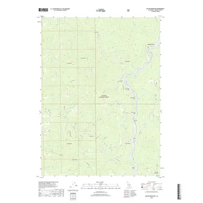
2018 Map of Dillon Mountain
USGS Topo · Published 2018About this map
Klamath River flows through the heart of this territory, carving a deep path past distinctive bars and landings like Rattlesnake Bar and Lone Pine Bar. This portion of Klamath National Forest is defined by its dramatic elevation changes, from the heights of Pony Peak and Dillon Mountain to the depths of Dark Canyon. The settlement of Cottage Grove sits at the northern bend of the river, while the landscape south is marked by numerous creeks such as Elliott Creek and Dillon Creek.
Find a feature on this map
50 named features on this map. Tap any name to fly to it.
Don’t see what you’re looking for? This feature index may not catch every label — zoom into the map to look around manually.
Map Details
Editions of this 2018 Dillon Mountain Map
This is the sole edition of this map. No revisions or reprints were ever made.
Other maps of this area

1914 · Seiad
USGS Topo · 1:125,000

1922 · Preston Peak
USGS Topo · 1:125,000

1922 · Seiad
USGS Topo · 1:125,000

1925 · Hoopa
USGS Topo · 1:125,000

1948 · Weed
USGS Topo · 1:250,000

1950 · Weed
USGS Topo · 1:250,000

1952 · Orleans
USGS Topo · 1:62,500

1955 · Dillon Mtn
USGS Topo · 1:62,500

1955 · Ukonom Lake
USGS Topo · 1:62,500

1955 · Forks of Salmon
USGS Topo · 1:62,500