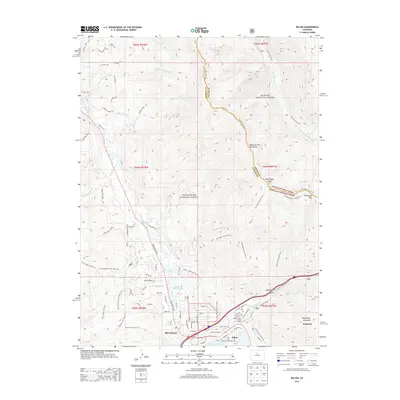
2013 Map of Dillon
USGS Topo · Published 2013About this map
Silverthorne and Dillon sit at the confluence of the Blue River and Straight Creek, serving as a modern nexus of recreation and infrastructure. The landscape is defined by the high elevations of the Williams Fork Mountains and the massive basin of the Dillon Reservoir to the south. This 2013 survey illustrates the dense network of residential development stretching from the banks of the reservoir up into the foothills, particularly around Blue River Ranch Lakes and the neighborhoods near Willow Creek. The map documents a heavily managed wilderness, where the Arapaho National Forest and White River National Forest are accessed through an extensive system of trails like the Ute Peak Trail 24 and Ptarmigan Loop Trail 69.1, which trace the high ridges and glacial valleys such as Laskey Gulch.
Find a feature on this map
96 named features on this map. Tap any name to fly to it.
Don’t see what you’re looking for? This feature index may not catch every label — zoom into the map to look around manually.
Map Details
Editions of this 2013 Dillon Map
This is the sole edition of this map. No revisions or reprints were ever made.
Other maps of this area

1924 · Montezuma
USGS Topo · 1:62,500

1924 · Fraser
USGS Topo · 1:62,500

1926 · Fraser
USGS Topo · 1:62,500

1926 · Montezuma
USGS Topo · 1:62,500

1929 · Dillon
USGS Topo · 1:62,500

1933 · Montezuma
USGS Topo · 1:62,500

1933 · Ute Peak
USGS Topo · 1:62,500

1934 · Dillon
USGS Topo · 1:62,500

1937 · Ute Peak
USGS Topo · 1:62,500

1953 · Denver
USGS Topo · 1:250,000