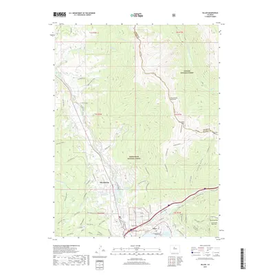
2019 Map of Dillon
USGS Topo · Published 2019About this map
Silverthorne and Dillon serve as the central hubs of this mountain landscape, positioned where the Blue River flows toward the sprawling Dillon Reservoir. The map illustrates a complex network of residential developments and recreation-based expansion, with named residential clusters like Mesa Cortina, Royal Buffalo, and Arctic Placer creeping up the slopes of the surrounding ranges. Institutional presence is noted at Colorado Mountain College Dillon, while the rugged eastern boundary is defined by high peaks such as Ute Peak and Ptarmigan Peak.
Find a feature on this map
111 named features on this map. Tap any name to fly to it.
Don’t see what you’re looking for? This feature index may not catch every label — zoom into the map to look around manually.
Map Details
Editions of this 2019 Dillon Map
This is the sole edition of this map. No revisions or reprints were ever made.
Other maps of this area

1924 · Montezuma
USGS Topo · 1:62,500

1924 · Fraser
USGS Topo · 1:62,500

1926 · Fraser
USGS Topo · 1:62,500

1926 · Montezuma
USGS Topo · 1:62,500

1929 · Dillon
USGS Topo · 1:62,500

1933 · Montezuma
USGS Topo · 1:62,500

1933 · Ute Peak
USGS Topo · 1:62,500

1934 · Dillon
USGS Topo · 1:62,500

1937 · Ute Peak
USGS Topo · 1:62,500

1953 · Denver
USGS Topo · 1:250,000