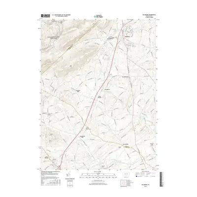
2016 Map of Dillsburg
USGS Topo · Published 2016About this map
The northern reaches of the Blue Ridge mountains meet the agricultural valleys of York and Adams Counties in this topographical study. High ridges like Long Mtn and Stone Head dominate the northwestern corner, where the Appalachian National Scenic Trail winds past peaks like Center Point Knob. Descending from these heights, the landscape transitions into a network of small crossroad settlements and farmsteads. The historic Baltimore Pike serves as a primary artery, connecting Dillsburg and Franklintown with southern locales such as York Springs.
Find a feature on this map
48 named features on this map. Tap any name to fly to it.
Don’t see what you’re looking for? This feature index may not catch every label — zoom into the map to look around manually.
Map Details
Editions of this 2016 Dillsburg Map
This is the sole edition of this map. No revisions or reprints were ever made.
Other maps of this area

1904 · Carlisle
USGS Topo · 1:62,500

1906 · New Cumberland
USGS Topo · 1:62,500

1908 · Gettysburg
USGS Topo · 1:62,500

1920 · Hanover
USGS Topo · 1:62,500

1922 · Hanover
USGS Topo · 1:62,500

1942 · Gettysburg
USGS Topo · 1:125,000

1943 · New Cumberland
USGS Topo · 1:62,500

1943 · Carlisle
USGS Topo · 1:62,500
1944 · Biglerville
USGS Topo · 1:31,680

1944 · Hampton
USGS Topo · 1:31,680