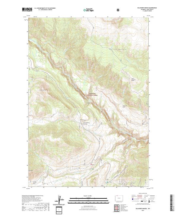
2021 Map of Dillworth Bench
USGS Topo · Published 2021About this map
The Clarks Fork Wild And Scenic River carves a deep canyon through this portion of the Shoshone National Forest in Park County. The landscape is defined by the high, flat expanses of Dillworth Bench and Upper Dillworth Bench which overlook the river's path. A network of historic pack trails, including the Clarks Fork Trl and Russell Creek Trl, navigate the elevation changes between the peaks and the river valley. To the south, the Sunlight Basin opens up near the confluence of Sunlight Cr and Elk Cr, where the Sunlight Rd provides access to this remote interior. Notable local landmarks include the Frank N Hammitt Monument located on the slopes of Antelope Mtn, and the distinctive narrow passage known as The Box along the main river corridor. These features reflect the area's history of early exploration and its long-standing status as protected public land.
Find a feature on this map
44 named features on this map. Tap any name to fly to it.
Don’t see what you’re looking for? This feature index may not catch every label — zoom into the map to look around manually.
Map Details
Editions of this 2021 Dillworth Bench Map
This is the sole edition of this map. No revisions or reprints were ever made.
Other maps of this area

1896 · Crandall Creek
USGS Topo · 1:125,000

1899 · Crandall
USGS Topo · 1:125,000

1949 · Pat O'Hara Mountain
USGS Topo · 1:62,500

1950 · Deep Lake
USGS Topo · 1:62,500

1955 · Cody
USGS Topo · 1:250,000

1956 · Beartooth Butte
USGS Topo · 1:62,500

1956 · Dead Indian Peak
USGS Topo · 1:62,500

1958 · Cody
USGS Topo · 1:250,000

1962 · Cody
USGS Topo · 1:250,000

1980 · Cody
USGS Topo · 1:100,000