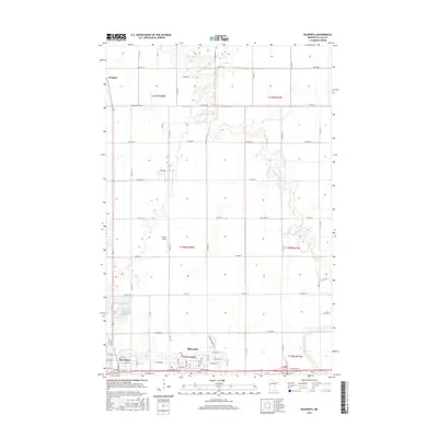
2016 Map of Dilworth
USGS Topo · Published 2016About this map
The Buffalo River meanders through the heart of the Clay County plains, defining the agricultural landscape just north of the growing centers of Moorhead and Dilworth. This 2016 survey illustrates the precise transition from the urban street grids of Moorhead to the sprawling township sections of the Red River Valley. The grid-like efficiency of the county's road network, featuring routes like Co State Aid Hwy 26 and Clay Cord 22, partitions the land into large parcels such as Jerger's Field. To the north, the settlement of Kragnes stands near the river's edge, while the South Branch Buffalo River enters from the southeast. For researchers, the map provides a contemporary look at land use, showing how legacy township lines like t140n r48w still govern the layout of modern infrastructure and residential expansion.
Find a feature on this map
41 named features on this map. Tap any name to fly to it.
Don’t see what you’re looking for? This feature index may not catch every label — zoom into the map to look around manually.
Map Details
Editions of this 2016 Dilworth Map
This is the sole edition of this map. No revisions or reprints were ever made.
Other maps of this area

1895 · Fargo
USGS Topo · 1:125,000

1897 · Fargo
USGS Topo · 1:125,000

1952 · Grand Forks
USGS Topo · 1:250,000

1953 · Fargo
USGS Topo · 1:250,000

1956 · Fargo
USGS Topo · 1:250,000

1956 · Grand Forks
USGS Topo · 1:250,000

1959 · Fargo North
USGS Topo · 1:24,000

1959 · Fargo South
USGS Topo · 1:24,000

1963 · Georgetown
USGS Topo · 1:24,000

1964 · Sabin
USGS Topo · 1:24,000
Featured Places
- Moorhead, MN
- Dilworth, MN
- Villa di Sole Mobile Park, Dilworth
- Cottonwood Acres, Dilworth
- Park Lane Mobile Home Park, Dilworth