
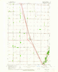
1963 Map of Georgetown
USGS Topo · Published 1964About this map
The Red River of the North forms a complex, serpentine border between North Dakota and Minnesota in this early 1960s survey. The landscape is defined by the dramatic meandering of the main channel and its tributaries, including the Buffalo River and the Sheyenne River, which cut through the flat agricultural townships of Wiser, Georgetown, Harwood, and Kragnes. The extensive system of drainage infrastructure, such as County Ditch No 23 B and County Ditch No 14, underscores the intensive land management required in this fertile valley.
Find a feature on this map
19 named features on this map. Tap any name to fly to it.
Don’t see what you’re looking for? This feature index may not catch every label — zoom into the map to look around manually.
Map Details
Editions of this 1963 Georgetown Map
This is the sole edition of this map. No revisions or reprints were ever made.
Other maps of this area

1895 · Fargo
USGS Topo · 1:125,000

1897 · Fargo
USGS Topo · 1:125,000

1952 · Grand Forks
USGS Topo · 1:250,000

1953 · Fargo
USGS Topo · 1:250,000

1956 · Fargo
USGS Topo · 1:250,000

1956 · Grand Forks
USGS Topo · 1:250,000

1959 · Fargo North
USGS Topo · 1:24,000

1959 · West Fargo
USGS Topo · 1:24,000
1963 · Argusville
USGS Topo · 1:24,000

1963 · Perley
USGS Topo · 1:24,000