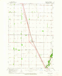
1963 Map of Argusville
USGS Topo · Published 1964About this map
The Sheyenne River winds through the southeastern corner of this North Dakota landscape, providing a sharp contrast to the rigid section lines that define the surrounding prairie. During this early 1960s survey, the local infrastructure was in a state of transition, most notably marked by the Great Northern Under Construction rail line cutting diagonally across the township toward Argusville. This settlement serves as the central hub of the map, situated within the Argusville Corporate Limits and featuring local landmarks such as the High Sch and the Argusville Cem to the west. The map captures a moment when the rural grid of Gardner, Wiser, Berlin, and Harwood townships remained largely agricultural, punctuated by small developments like Brooktree Park near the riverbanks.
Find a feature on this map
11 named features on this map. Tap any name to fly to it.
Don’t see what you’re looking for? This feature index may not catch every label — zoom into the map to look around manually.
Map Details
Editions of this 1963 Argusville Map
2 editions found
Other maps of this area

1895 · Fargo
USGS Topo · 1:125,000

1895 · Casselton
USGS Topo · 1:125,000

1897 · Fargo
USGS Topo · 1:125,000

1897 · Casselton
USGS Topo · 1:125,000

1952 · Grand Forks
USGS Topo · 1:250,000

1953 · Fargo
USGS Topo · 1:250,000

1956 · Fargo
USGS Topo · 1:250,000

1956 · Grand Forks
USGS Topo · 1:250,000

1959 · Fargo North
USGS Topo · 1:24,000

1959 · West Fargo
USGS Topo · 1:24,000