Loading...
Loading map...2022 Map of Dilworth
USGS Topo · Published 2022About this map
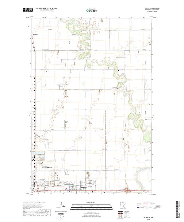
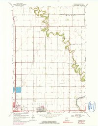
Dilworth and the eastern edge of Moorhead anchor the southern portion of this landscape, where residential street grids meet the agricultural expanse of the Red River Valley. The terrain is defined by the winding course of the Buffalo River, which meanders through the northern sections, and the South Branch Buffalo River in the southeast. These waterways create natural breaks in the otherwise rigid township and range grid system, dictated by local routes like Co Hwy 11 and 100th Ave N.
Find a feature on this map
63 named features on this map. Tap any name to fly to it.
Don’t see what you’re looking for? This feature index may not catch every label — zoom into the map to look around manually.
Map Details
Date Portrayed2022
Date Published2022
PublisherU.S. Geological Survey
Map TypeTopographic
Scale1:24000
Physical Dimensions24 x 29 inches
Editions of this 2022 Dilworth Map
This is the sole edition of this map. No revisions or reprints were ever made.
Historical Maps of North Crystal Creek 1st Subdivision Through Time
Featured Locations
- Moorhead, MN
- Dilworth, MN
- Cottonwood Acres, Dilworth
- Park Lane Mobile Home Park, Dilworth
- Villa di Sole Mobile Park, Dilworth
Source Details
SourceU.S. Geological Survey
CopyrightPublic Domain