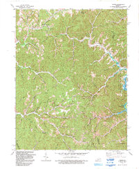
1992 Map of Dingus
USGS Topo · Published 1992About this map
The rugged intersections of Morgan, Elliott, Lawrence, and Magoffin Counties come to life in this early 1990s record of eastern Kentucky's coal and gas country. Small rural settlements like Crockett, Dingus, and Moon anchor a landscape defined by narrow creek valleys and steep ridges, such as those surrounding South Creek Valley and Gum Bottom. The map reveals the critical importance of energy extraction to the local economy, with numerous mines, oil wells, and gas wells scattered across the terrain, including a significant Oil and Gas Field near Sandlick Creek.
Find a feature on this map
71 named features on this map. Tap any name to fly to it.
Don’t see what you’re looking for? This feature index may not catch every label — zoom into the map to look around manually.
Map Details
Editions of this 1992 Dingus Map
This is the sole edition of this map. No revisions or reprints were ever made.
Other maps of this area

1886 · Prestonsburg
USGS Topo · 1:125,000

1889 · Salyersville
USGS Topo · 1:125,000

1891 · Salyersville
USGS Topo · 1:125,000

1892 · Prestonsburg
USGS Topo · 1:125,000

1899 · Salyersville
USGS Topo · 1:125,000

1903 · Kenova
USGS Topo · 1:125,000

1904 · Kenova
USGS Topo · 1:125,000

1915 · Paintsville
USGS Topo · 1:48,000

1917 · Paintsville
USGS Topo · 1:62,500

1950 · Isonville
USGS Topo · 1:24,000