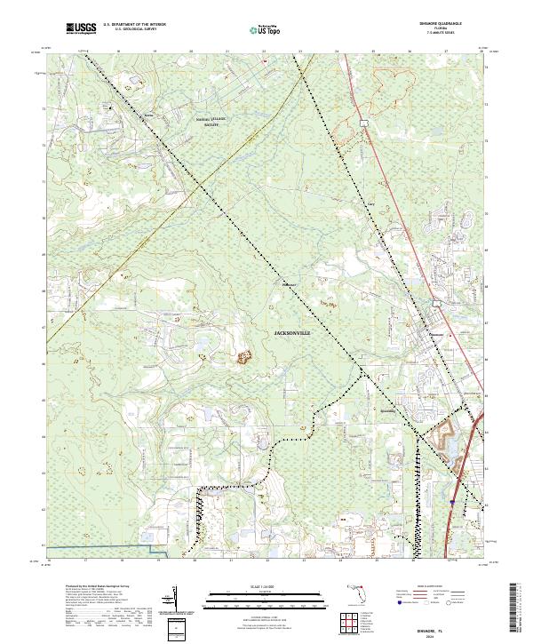
2024 Map of Dinsmore
USGS Topo · Published 2024About this map
The Nassau Village-Ratliff area and its surrounding Florida woodlands are defined by a complex network of waterways and drainage. The Trout River and Thomas Creek meander through low-lying terrain, flanked by established settlements such as Dinsmore, Spaulding, and Plummer. Genealogists and local historians can locate the Keen Cem near Keene, which sits along the border between Nassau and Duval Counties. The southern portion of the landscape is notably occupied by the OLF Whitehouse airfield, illustrating the region's intersection of military infrastructure and residential growth. This modern survey details the intricate residential road network, including family-named routes like Keen Cemetery Rd and Crawford Kent Rd, that connect these small communities within the greater Jacksonville metropolitan periphery.
Find a feature on this map
109 named features on this map. Tap any name to fly to it.
Don’t see what you’re looking for? This feature index may not catch every label — zoom into the map to look around manually.
Map Details
Editions of this 2024 Dinsmore Map
This is the sole edition of this map. No revisions or reprints were ever made.
Other maps of this area

1917 · Cambon
USGS Topo · 1:62,500

1917 · Hilliard
USGS Topo · 1:62,500

1918 · St Marys
USGS Topo · 1:62,500

1918 · Cambon
USGS Topo · 1:62,500

1918 · Jacksonville
USGS Topo · 1:62,500

1919 · St Marys
USGS Topo · 1:62,500

1919 · Hilliard
USGS Topo · 1:62,500

1948 · Jacksonville
USGS Topo · 1:250,000

1950 · Trout River
USGS Topo · 1:24,000
1950 · Jacksonville
USGS Topo · 1:24,000