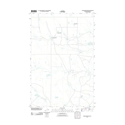
2011 Map of Dione Reservoir
USGS Topo · Published 2011About this map
The Dione Reservoir and surrounding ranching lands in Phillips County characterize this landscape of the Missouri River country of north-central Montana. The map documents a sophisticated system of water management essential for livestock and irrigation in a semi-arid climate, featuring numerous family-named dams and reservoirs. Among these are the Veseth and Veseth Number 1 Dam and Veseth and Veseth Number 2 Dam, along with the Blunt Ranches Number 2 Dam.
Find a feature on this map
12 named features on this map. Tap any name to fly to it.
Don’t see what you’re looking for? This feature index may not catch every label — zoom into the map to look around manually.
Map Details
Editions of this 2011 Dione Reservoir Map
This is the sole edition of this map. No revisions or reprints were ever made.
Other maps of this area

1954 · Jordan
USGS Topo · 1:250,000

1954 · Lewistown
USGS Topo · 1:250,000

1956 · Jordan
USGS Topo · 1:250,000

1958 · Jordan
USGS Topo · 1:250,000

1959 · Lewistown
USGS Topo · 1:250,000

1964 · Jordan
USGS Topo · 1:250,000

1965 · Karsten Coulee
USGS Topo · 1:24,000

1965 · Whitcomb Lake
USGS Topo · 1:24,000
1965 · Stratton Reservoir
USGS Topo · 1:24,000
1965 · Holzhey Reservoir
USGS Topo · 1:24,000