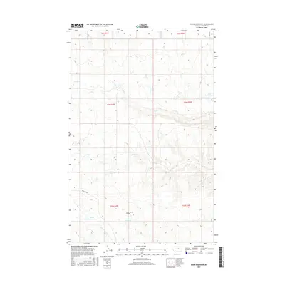
2017 Map of Dione Reservoir
USGS Topo · Published 2017About this map
Dione Reservoir and several other small impoundments define the drainage patterns of this Phillips County landscape. The area is characterized by intermittent waterways like Second Cr and Third Cr, which carve through the plains. Local land management is evident in the naming of features such as Horse Pasture Coulee, reflecting a history of ranching and livestock movement. These small reservoirs, including Archie Reservoir, Carberry Reservoir, and Carter Reservoir, were essential for water storage in this arid environment. Transportation is limited to a handful of routes, notably Indian Lake Rd in the southwest and Regina Rd in the northeast, which connect the isolated pastures and water sources across the township lines of the Missouri River Breaks region.
Find a feature on this map
16 named features on this map. Tap any name to fly to it.
Don’t see what you’re looking for? This feature index may not catch every label — zoom into the map to look around manually.
Map Details
Editions of this 2017 Dione Reservoir Map
This is the sole edition of this map. No revisions or reprints were ever made.
Other maps of this area

1954 · Jordan
USGS Topo · 1:250,000

1954 · Lewistown
USGS Topo · 1:250,000

1956 · Jordan
USGS Topo · 1:250,000

1958 · Jordan
USGS Topo · 1:250,000

1959 · Lewistown
USGS Topo · 1:250,000

1964 · Jordan
USGS Topo · 1:250,000

1965 · Karsten Coulee
USGS Topo · 1:24,000

1965 · Whitcomb Lake
USGS Topo · 1:24,000
1965 · Stratton Reservoir
USGS Topo · 1:24,000
1965 · Holzhey Reservoir
USGS Topo · 1:24,000