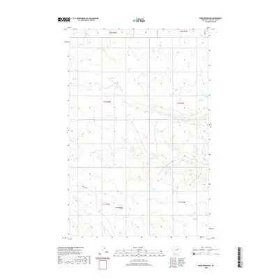
2020 Map of Dione Reservoir
USGS Topo · Published 2020About this map
Dione Reservoir and several other catchments define the water management landscape of this Phillips County terrain, where intermittent drainages like Second Cr and Third Cr carve through the high plains. The map illustrates a remote grazing region structured by the Public Land Survey System, with township and range lines orienting the sparse network of rural roads. Features like Horse Pasture Coulee suggest the historical and ongoing use of the land for livestock, while small-scale water storage sites such as Archie Reservoir and Carberry Reservoir are critical landmarks in an arid environment. The southern portion of the quadrangle is marked by the N Fork Fourchette Cr, which drains toward the Missouri River breaks beyond the map's edge.
Find a feature on this map
16 named features on this map. Tap any name to fly to it.
Don’t see what you’re looking for? This feature index may not catch every label — zoom into the map to look around manually.
Map Details
Editions of this 2020 Dione Reservoir Map
This is the sole edition of this map. No revisions or reprints were ever made.
Other maps of this area

1954 · Jordan
USGS Topo · 1:250,000

1954 · Lewistown
USGS Topo · 1:250,000

1956 · Jordan
USGS Topo · 1:250,000

1958 · Jordan
USGS Topo · 1:250,000

1959 · Lewistown
USGS Topo · 1:250,000

1964 · Jordan
USGS Topo · 1:250,000

1965 · Karsten Coulee
USGS Topo · 1:24,000

1965 · Whitcomb Lake
USGS Topo · 1:24,000
1965 · Stratton Reservoir
USGS Topo · 1:24,000
1965 · Holzhey Reservoir
USGS Topo · 1:24,000