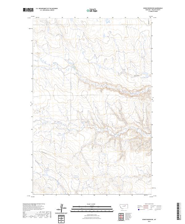
2024 Map of Dione Reservoir
USGS Topo · Published 2024About this map
Dione Reservoir and several other managed water catchments dot this Phillips County landscape, illustrating the critical role of water storage in the high plains. The terrain is defined by a network of drainage systems, including the North Fork Fourchette Creek and Third Creek, which carve through the land alongside Second Creek. These water features, combined with the presence of Carter Reservoir, Archie Reservoir, and Carberry Reservoir, suggest a landscape shaped by agricultural or livestock needs where seasonal runoff is carefully captured. Transportation is limited to a few arterial routes such as Regina Rd and Indian Lake Rd, which provide access through the vast public land survey sections. The map preserves the specific locations of these rural landmarks and the seasonal coulees, such as Tank Coulee, that drain the surrounding breaks.
Find a feature on this map
16 named features on this map. Tap any name to fly to it.
Don’t see what you’re looking for? This feature index may not catch every label — zoom into the map to look around manually.
Map Details
Editions of this 2024 Dione Reservoir Map
This is the sole edition of this map. No revisions or reprints were ever made.
Other maps of this area

1954 · Jordan
USGS Topo · 1:250,000

1954 · Lewistown
USGS Topo · 1:250,000

1956 · Jordan
USGS Topo · 1:250,000

1958 · Jordan
USGS Topo · 1:250,000

1959 · Lewistown
USGS Topo · 1:250,000

1964 · Jordan
USGS Topo · 1:250,000

1965 · Karsten Coulee
USGS Topo · 1:24,000

1965 · Whitcomb Lake
USGS Topo · 1:24,000
1965 · Stratton Reservoir
USGS Topo · 1:24,000
1965 · Holzhey Reservoir
USGS Topo · 1:24,000