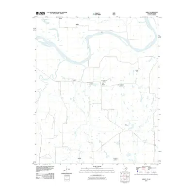
2010 Map of Direct
USGS Topo · Published 2010About this map
The Red River snakes along the northern boundary of this Texas-Oklahoma borderlands area, defining a landscape of low-lying wetlands and agricultural plains. The river's influence is evident in the oxbow-like formations of Crane Lake and Oberlin Lake, and the historic crossing at Oberlin Ferry. Small rural centers such as Direct, East Direct, and Georgia are connected by a network of farm roads and county lines, reflecting a decentralized settlement pattern typical of the Red River Valley.
Find a feature on this map
40 named features on this map. Tap any name to fly to it.
Don’t see what you’re looking for? This feature index may not catch every label — zoom into the map to look around manually.
Map Details
Editions of this 2010 Direct Map
This is the sole edition of this map. No revisions or reprints were ever made.
Other maps of this area

1903 · Paris
USGS Topo · 1:125,000

1947 · Honey Grove
USGS Topo · 1:62,500

1948 · Grant
USGS Topo · 1:62,500

1948 · Paris
USGS Topo · 1:62,500

1948 · Direct
USGS Topo · 1:62,500

1949 · Direct
USGS Topo · 1:62,500

1949 · Honey Grove
USGS Topo · 1:62,500

1949 · Grant
USGS Topo · 1:62,500

1949 · Paris
USGS Topo · 1:62,500

1953 · Texarkana
USGS Topo · 1:250,000