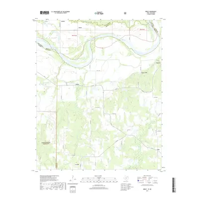
2019 Map of Direct
USGS Topo · Published 2019About this map
The Red River defines the winding northern boundary of this landscape, separating the plains of Oklahoma from the northern reaches of Lamar and Fannin counties in Texas. This 2019 survey documents a rural agricultural region characterized by a network of farm-to-market roads and county lines, including the corner of the Caddo National Grassland in the southwest. Small settlements like Direct, Georgia, and Unity serve as local hubs for the surrounding farmsteads, while the Pyles Cem offers a point of interest for those tracing family history in the area.
Find a feature on this map
46 named features on this map. Tap any name to fly to it.
Don’t see what you’re looking for? This feature index may not catch every label — zoom into the map to look around manually.
Map Details
Editions of this 2019 Direct Map
This is the sole edition of this map. No revisions or reprints were ever made.
Other maps of this area

1903 · Paris
USGS Topo · 1:125,000

1947 · Honey Grove
USGS Topo · 1:62,500

1948 · Grant
USGS Topo · 1:62,500

1948 · Paris
USGS Topo · 1:62,500

1948 · Direct
USGS Topo · 1:62,500

1949 · Direct
USGS Topo · 1:62,500

1949 · Honey Grove
USGS Topo · 1:62,500

1949 · Grant
USGS Topo · 1:62,500

1949 · Paris
USGS Topo · 1:62,500

1953 · Texarkana
USGS Topo · 1:250,000