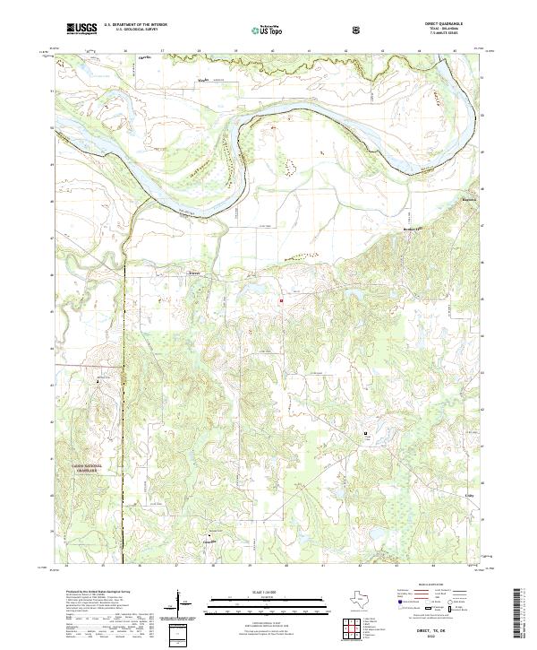
2022 Map of Direct
USGS Topo · Published 2022About this map
The Red River defines the border between Oklahoma and Texas in this contemporary record of Lamar County's northern edge. The landscape transition from the river bottomlands to the wooded reaches of the Caddo National Grassland is marked by a network of rural settlements, including Direct, Bunker Hill, and Ragtown. This area remains largely defined by its watercourses, with Bois d'Arc Creek and Slough Creek draining the southern portion of the sheet. For genealogists, the map identifies several local burial sites such as Whitten Cem, Pyles Cem, and Georgia Cem near the small community of Georgia. The dense collection of county roads suggests a resilient rural infrastructure connecting these historic agrarian settlements long after the peak of the cotton era.
Find a feature on this map
48 named features on this map. Tap any name to fly to it.
Don’t see what you’re looking for? This feature index may not catch every label — zoom into the map to look around manually.
Map Details
Editions of this 2022 Direct Map
This is the sole edition of this map. No revisions or reprints were ever made.
Other maps of this area

1903 · Paris
USGS Topo · 1:125,000

1947 · Honey Grove
USGS Topo · 1:62,500

1948 · Grant
USGS Topo · 1:62,500

1948 · Paris
USGS Topo · 1:62,500

1948 · Direct
USGS Topo · 1:62,500

1949 · Direct
USGS Topo · 1:62,500

1949 · Honey Grove
USGS Topo · 1:62,500

1949 · Grant
USGS Topo · 1:62,500

1949 · Paris
USGS Topo · 1:62,500

1953 · Texarkana
USGS Topo · 1:250,000